Montagu Pass Revisited
Friday, 30th September 2016
One of the four passes traversing the Outeniqua Mountains, the 8-kilometer long Montagu Pass, is one we never tire of…
Words: Jane Mulder
Pictures: Jane Mulder & Peter Mulder
Being fascinated by South Africa’s mountain passes, my husband and I often retrace our way along those that are accessible to us on any particular journey.
Declared a National monument in 1972, it is the oldest unaltered pass in South Africa, and links George with the village of Herold. Until the building of the Outeniqua Pass it was the main route between Cape Town and Grahamstown. Before that there was only the notoriously difficult wagon trail over the mountains – the Cradock Pass.
Named for the chief of the Central Roads Board, John Montagu, and planned by engineer Charles Michell, work began in 1844 with H.O. Farrell as superintendent. In 1845 he was replaced by Henry Fancourt White, a qualified surveyor recruited from Australia as a road inspector. White’s name is perpetuated in the town of Blanco and Fancourt Estate.
The former, originally called Whitesville, developed at White’s headquarters, and the change in name was apparently due to the fact that the modest White was embarrassed to have the settlement named after him. His home – Blanco House – was renamed Fancourt by his son Ernest Montagu White, and is now a hotel and part of the Fancourt golf estate.
The Montagu Pass was the first to be built utilising mainly convict labour, and was completed in 1847 at a cost of almost £36 000. It was hailed as “…one of the greatest works ever undertaken in this colony for the benefit of the community at large”. Veteran traveller Anthony Trollope enthused that it was “…equal to some of the mountain roads through the Pyrenees”. A wagon with a single team of oxen could ascend the pass in three hours, compared with the three days it had taken to negotiate the old Cradock Pass.

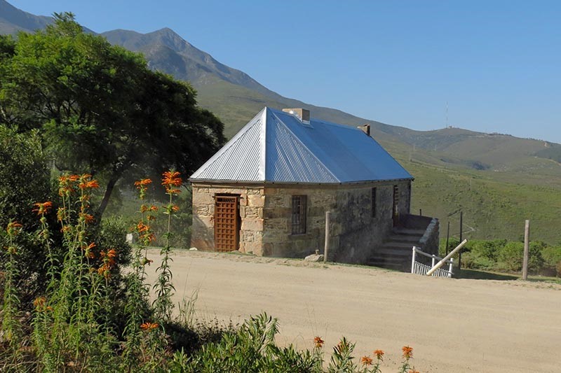
Tollhouse
It was opened to traffic in December 1847 and on 24th of February 1848 a tollgate was set up. Tolls remained in place until 31st December 1918. In 1902 the first motor car negotiated the pass – albeit with the help of muscled horse-power on the steepest stretch, Regoptrek.
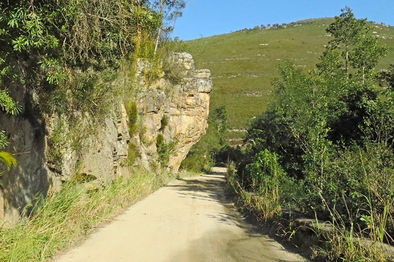
Bearing its age in mind one cannot help but marvel at the engineering skill involved in its construction, especially since dynamite had not yet been invented and gunpowder was used to blast a way through solid rock. Sheer drops of hundreds of metres as well as overhanging rocks had to be contended with, and there is not a single flat place on the whole pass. Today, though slow and dusty, it provides the traveller with a picturesque alternative route away from the bustle of high-speed traffic.
Soon after starting out one sees the first of descriptive signs erected by the George Museum Society in 1976. In the days of the ox-wagon Die Rus was an outspan where men and beasts could take a rest.
Travelling on an upward incline one soon comes to the old stone Tollhouse. The toll was two pennies per wheel, a penny per draft animal, two pennies for “losloop” animals, and half a penny for each sheep, goat or pig. Over the years some of the toll-keepers amassed quite a fortune. One of these was Charles Searle, who later founded the town of Great Brak River.
In July 1855 the tollhouse was all but destroyed in a forest fire, but was later repaired, and its thatched roof was replaced with corrugated iron. When we visited the tollhouse some years ago it was dilapidated and vandalised, but this time around we were pleased to see that it has been restored by The Friends of the Tollhouse. Perhaps one day it will be open to the public.
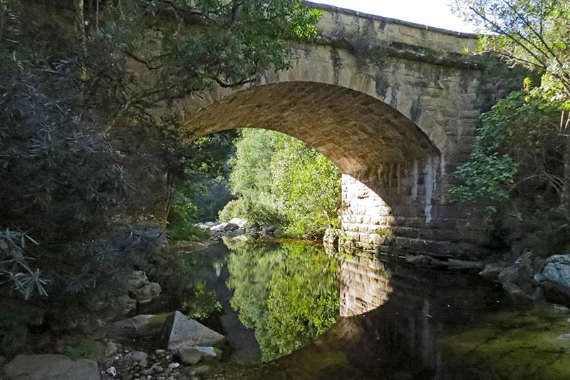
From this vantage point we looked across to the mountainside to where white beacons mark the path of the old Cradock Pass, part of which we’d hiked on an earlier visit to George. From here the road runs downward to Keur Rivier se Brug, named for the keurbooms that once grew here. Beautifully built of dressed stone, the bridge has a span of 9.1 metres.

Keur River Bridge
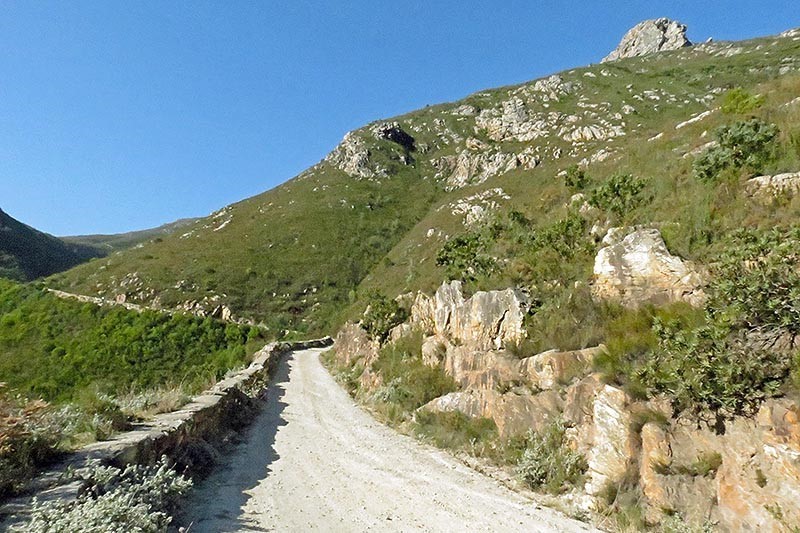
Across the bridge the pass proper begins. With the original dry-packed stone walls along one side, in its precarious ascent the road snakes along the edge of the Klip River Gorge. Die Noute is the narrowest point, made even more confining by overhanging cliffs. Two spans of oxen couldn’t pass each other here, the upcoming wagon having right of way. As soon as a driver crossed the bridge he cracked his whip to warn downgoing traffic to wait at a suitable point.
Further on is Moertjiesklip – a huge monolith on the left. Legend has it that it was dislodged during the building of the railway line, and on rolling down the mountainside it crushed a labourer to death.
Boshoff se Draai is a particularly sharp bend, and the story goes that a certain Mr Boschoff, who used to brag of his prowess at leading a team of oxen around the tricky curves of the pass, came to grief at this point when, miscalculating a manoeuvre, he landed on the horns of the leading ox and was tossed ignominiously over the wall! What a way to have one’s name go down in the annals of history.
Halfway up the pass on the left a sign heralds Old Smithy where the tools used in the building of the pass were sharpened and repaired. Sadly nothing remains but a dizzying drop into the gorge far below.
At Haarkantdraai the road curves sharply to the right, and at Remskoendraai the use of brakes was obligatory. Regoptrek is the steepest part of the pass where man and beast struggled against the one in six gradient. After having successfully negotiated this section travellers needed a rest, and they relaxed at Grog-draai where they either drank the waters of a nearby mountain spring, or enjoyed something stronger.
At Hotkantdraai the road curves sharply to the left, then comes Witkop se Draai, named after the white-coloured chalk koppie at the top of the pass – The Topping. The soft silica here was used to scrub pots and pans, and kaolin mining later took place in the area. The road then crosses under the railway line.
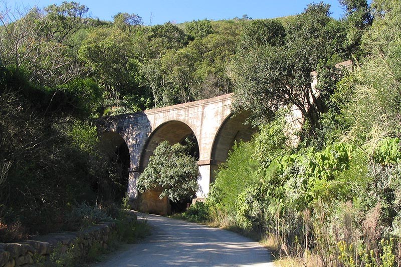
At the massive four-arched railway viaduct a signpost heralds Stinkhoutdraai, so named for the stinkwood trees that grew here. At the summit is a signpost marking Amanda se Graf. Amanda Pienaar, who died in 1973, was a George resident who wished to be interred at this magnificent viewsite. Her husband Pieter, who died in 1996, was buried at the same spot.
From here the road, flanked by proteas, descends, until finally, two kilometres before reaching Herold, is North Station, an old house which was once variously a hotel, a post office cum shop, and a police station.
Once past the tiny settlement of Herold we turned left towards Oudtshoorn at the T-junction and continued until we met the Outeniqua Pass. Recently upgraded, this is a superb road, and from three viewpoints one can enjoy magnificent views of the mountains and the other three passes.

Die Noute on descent

Regoptrek

Stinkhout Draai – Railway
George Tourism Office
124 York Street,
George.
Tel: (044) 801-9295
www.georgetourism.org.za
Getting there – directions from George to Montagu Pass
Tip: Before deciding to drive on the pass, it is advisable to check with George Tourism that it is in a satisfactory state of repair, especially if there have been heavy rains. The road is narrow and winding and steep in places.
- Take P.W. Botha Boulevard to York St. (1.1 km). Follow York St to C.J. Langenhoven Rd (4.4 km). Turn left into C.J. Langenhoven Road (N12/N9) (1 km). Follow to R404 and start of pass on the right (10.2 km)
OR
- From P.W. Botha Boulevard turn right into York St. (1.3 km). At the roundabout take 1st exit onto R102 (5.8 km). Turn right onto R404 (14.2 km). Start of pass is on the left.
Read more: The seven passes road linking Knysna and George
Article and photos courtesy of http://www.countrylife.co.za/travel/montagu-pass-re-visited
